11 years ago, in 2012, Apple introduced the world to its 3d maps which had both positive and negative repercussions, as many constructions appeared deformed. Much has improved in Apple Maps, but even today, some countries do not have this feature.
Page Contents:
Google then went ahead and now released its own 3D maps as “FlyOver” on Google Maps, with tourist attractions.
How FlyOver works
The resource Flyover is a feature available in Apple Maps that offers users an immersive 3D viewing experience of urban areas and selected landmarks.
Using Flyover, users can explore cities and specific locations from an aerial perspective, allowing a three-dimensional view of important buildings, streets, and landmarks.
Google took the lead
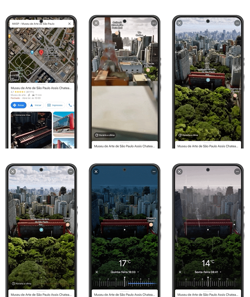
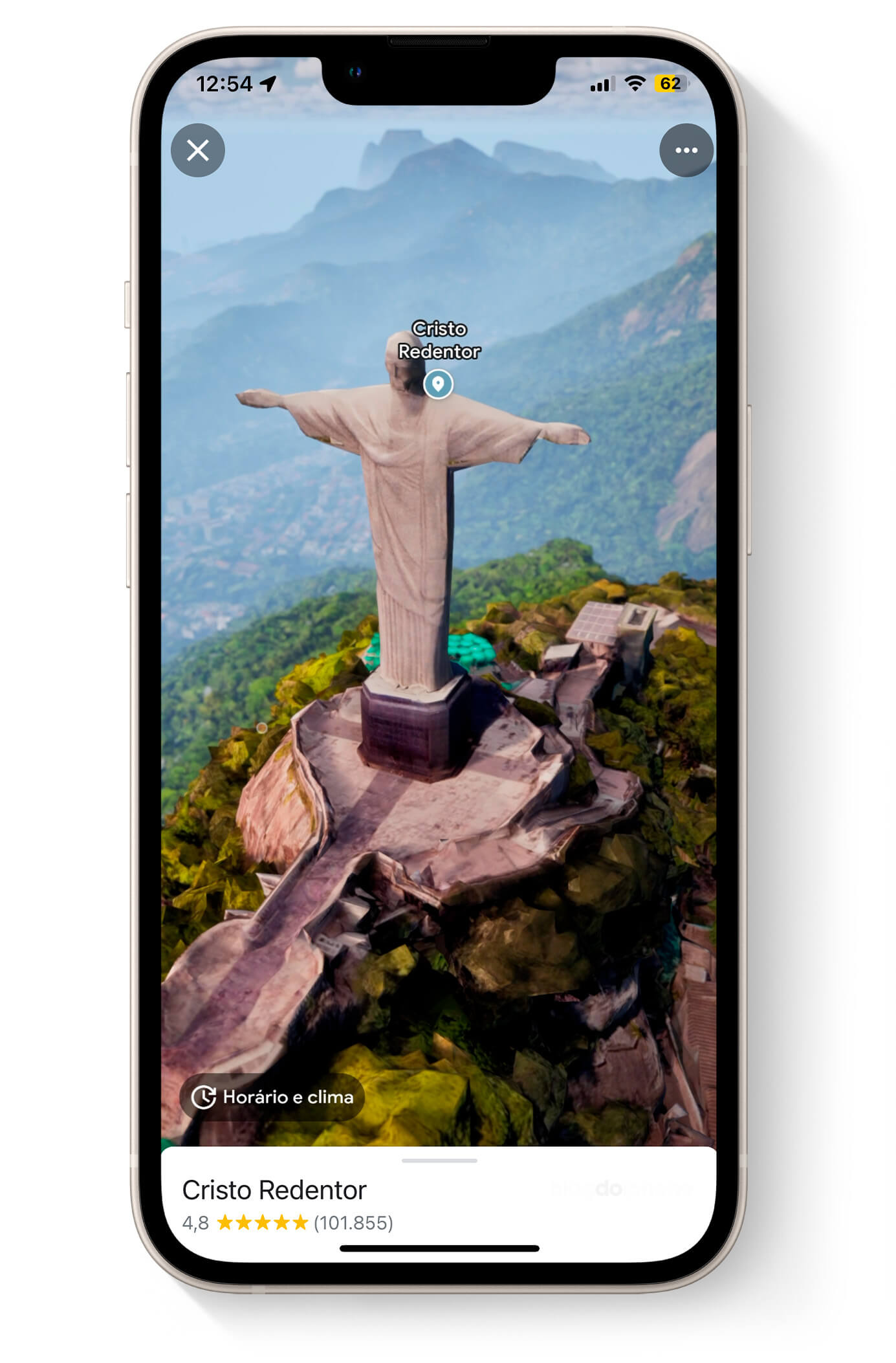
While some countries are still waiting for Apple’s 3D maps, Google has gone a step further by launching its Immersive Visualization in 3D on Google Maps, including landmarks.
This functionality offers users an immersive and realistic experience, allowing them to virtually explore places such as Christ the Redeemer, MASP, the Cathedral of Brasília, and the Metropolitan Cathedral of Fortaleza.
The feature is now available on the app. Google Maps for iOS
According to information from TechVaz at first, these are the sights available in Brazil:
Brasilia
- Brasilia’s Cathedral
- National Congress
- Memorial JK
- Planalto Palace
- Sanctuary of Saint John Bosco
- Itamaraty Palace
- National Museum of the Republic
Fortaleza
- Dragão do Mar Art and Culture Center
- Metropolitan Cathedral of Fortaleza
- Statue of Iracema Guardian
Rio de Janeiro
- Christ the Redeemer
- Maracanã
- Carioca Aqueduct
- Metropolitan Cathedral of San Sebastian in Rio de Janeiro
- Museum of Contemporary Art of Niteroi
- Municipal Theater of Rio de Janeiro
São Paulo
- Museum of Art of São Paulo Assis Chateaubriand (MASP)
- Pinacoteca of São Paulo
- St. Paul’s Cathedral
- Municipal Market of São Paulo
- Altino Arantes Building
- College Courtyard
- monastery of St. Benedict
- Catavento Museum
How images are generated
The technology Immersive View from Google is a little different from the one used by Apple to generate 3D maps.
While Apple does a 3D aerial scan with specialized equipment, in Google Maps the images are generated with artificial intelligence which uses the archive of billions of images registered in the Street View as well as aerial photographs, to create the 3D map.
The result is not perfect. In fact, it is very reminiscent of Apple’s deformed maps from 2013. But who knows, maybe Google won’t take less than 10 years to improve?
In the coming weeks, Google also intends to launch the Indoor Live View for Guarulhos Airport, helping people easily navigate the terminals of Latin America’s busiest air transportation hub.


